Optics, Productivity, Documentation
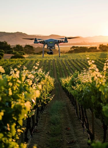
Your Trusted, Local, Drone Partner for Delaware's Construction, Solar, and Agriculture Industries.
Launching October 27th, 2025
About Xero Vector Systems
At Xero Vector Systems, we give builders, farmers, and solar operators a safer, faster, and more cost-effective way to see the truth about their projects.
Our high-resolution visuals and thermal scans uncover problems before they become costly delays — from overheating solar panels and leaking roofs to crop stress and construction hazards.
With drones, there’s no scaffolding, shutdowns, or workers put in harm’s way. We deliver clear data within fast, giving you the confidence to make the right call and keep your projects on track.
Based in Delaware, we’re FAA-certified, fully insured, licensed and built for responsiveness. Whether it’s a single inspection or ongoing progress monitoring, you get reliable, actionable data every time. Your projects move forward. Your risks go down. Your results go up.
Tech & Vision
We see technology as a tool to create lasting impacts. Our drones don’t just capture the present — they document change, growth, and progress in ways that transform how projects are managed.
From generating precise maps and models to integrating data directly into modern construction and asset management platforms, we’re committed to pushing the boundaries of what’s possible.
As drone hardware and software continue to evolve, we invest early so our clients stay ahead of the curve. Our vision is simple: combine innovation with partnership to deliver the best outcome — because real success comes from tailored solutions.
Our Core Services
Xero Vector Systems stays sharp on industry needs, innovation, and what truly drives results. Our drones and data deliver not just visuals—but verified insight and proof of concept tailored to your business. We adapt to the way you operate, bringing aerial intelligence that empowers your decisions while respecting your expertise.
If your business requires something unique to fit the job, we will invest and collaborate with you and your teams to present the best solution.
Our success is measured in efficiency gained, risks reduced, and opportunities unlocked—because your growth and ROI are the story we’re here to tell.
– Kevin C, Founder
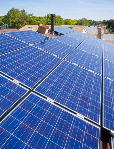
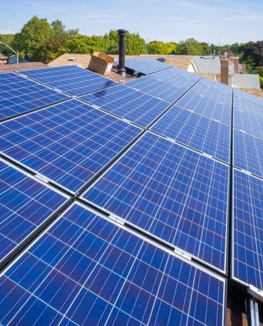
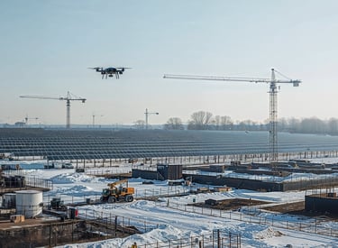
☀️ Solar
Pre-Construction Mapping – High-accuracy RTK mapping to support site design, panel layout, and infrastructure planning.
Construction Progress – Regular aerial updates and orthomosaics that keep developers and contractors aligned on schedules and milestones.
Thermal Inspections – Advanced infrared imaging to detect hot spots, cracked modules, wiring faults, and other system defects that reduce efficiency.
Compliance & Warranty Reporting – Detailed visual and thermal reports formatted to meet O&M and manufacturer warranty requirements.
Vegetation & Site Monitoring – Identify shading, encroachment, and storm damage quickly to protect long-term output.
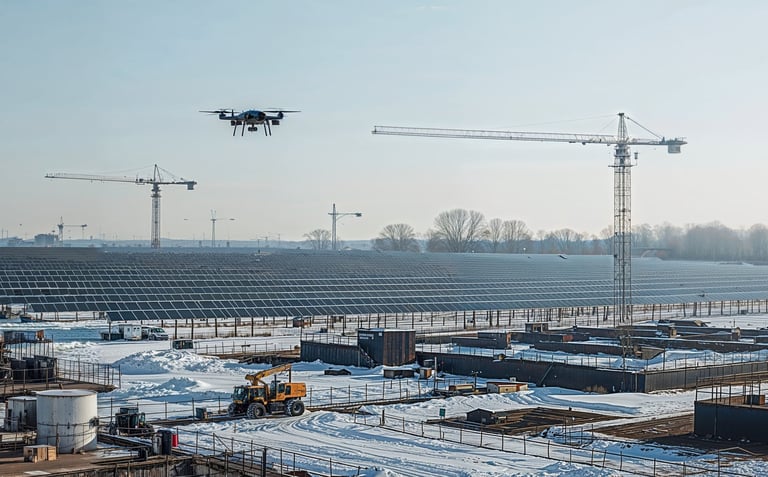
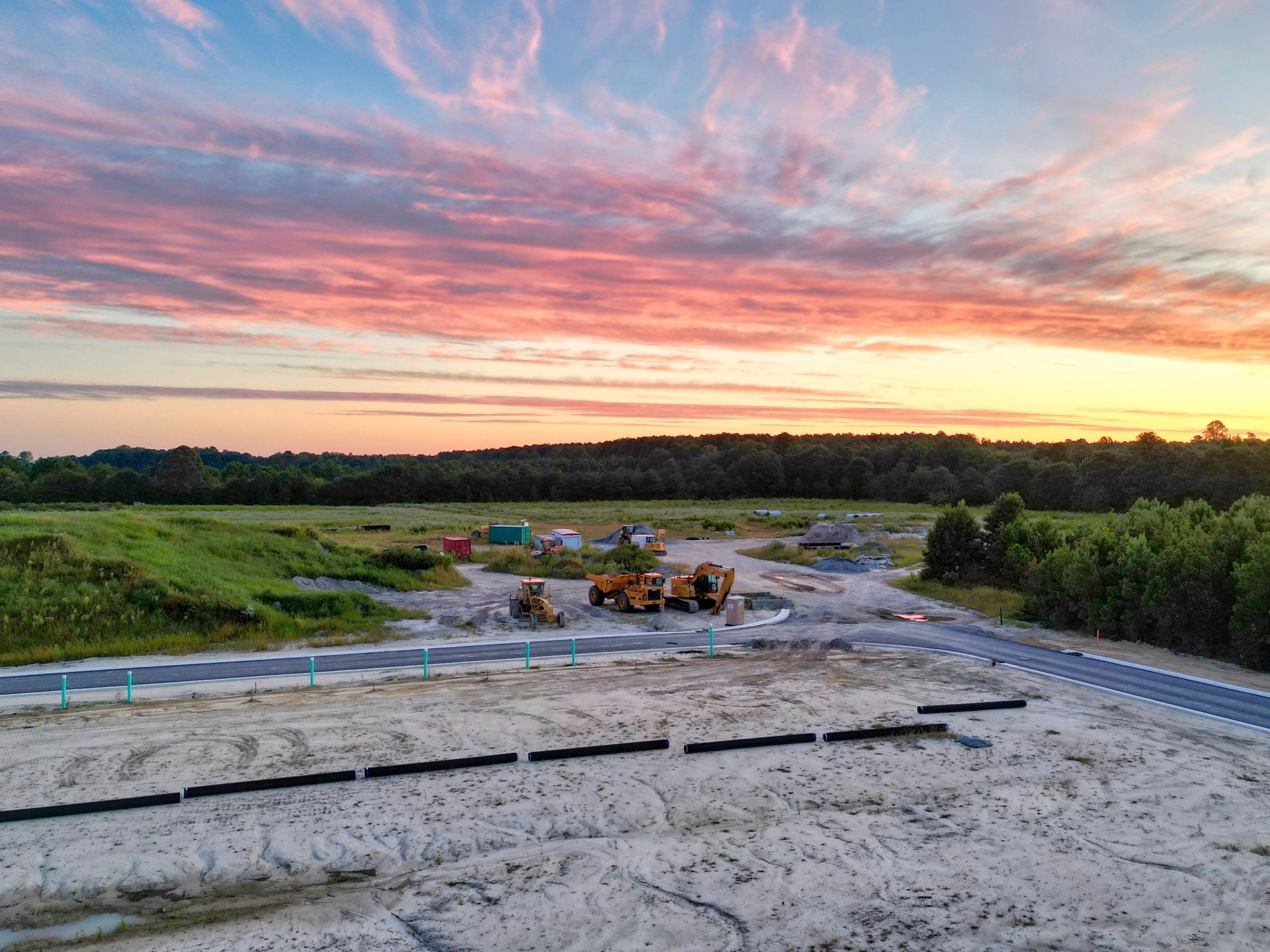
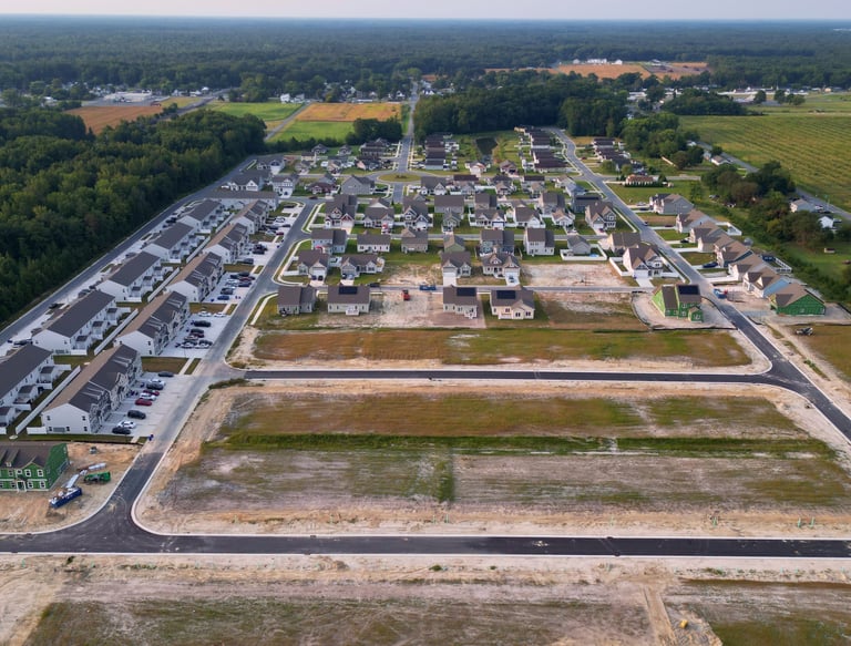
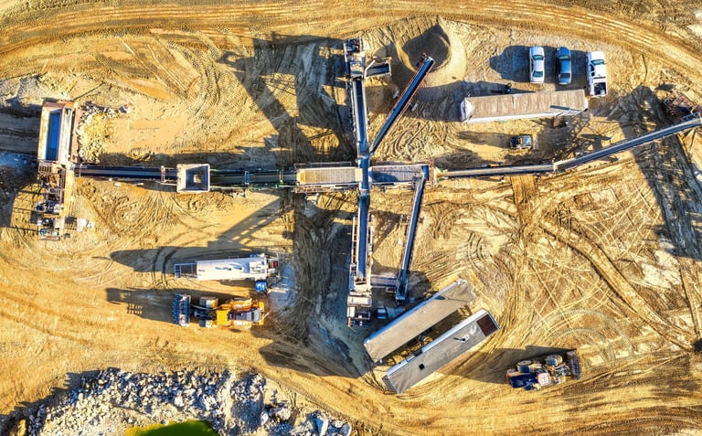
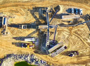
🏗️ Construction & Development
Progress Monitoring – Consistent aerial documentation from the same vantage points, providing stakeholders with reliable updates on project milestones.
Orthomosaic Mapping – High-accuracy RTK maps that give project managers and engineers a precise overview of the entire site.
Volume Measurements – Fast, cost-effective stockpile and earthwork calculations without the need for expensive survey equipment.
Marketing Media – Professional-grade aerial imagery and video to highlight progress, milestones, and finished builds.
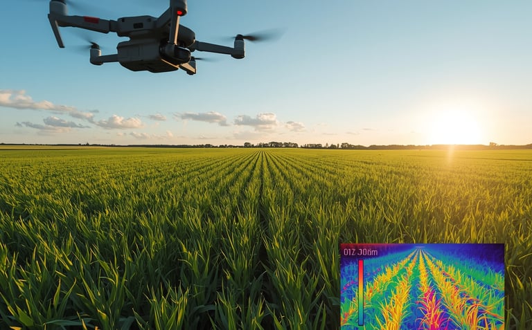

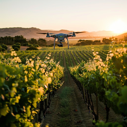
Field Mapping & Crop Analysis – High-accuracy RTK maps stitched into detailed orthomosaics, giving growers a clear view of field health and variability.
Thermal Crop Monitoring – Infrared imaging to identify heat stress, irrigation issues, and early signs of disease or nutrient deficiencies before yield is lost.
Drainage & Irrigation Assessment – Thermal and visual scans to detect poor water distribution, leaks, and standing water that impact productivity.
Livestock & Facility Monitoring – Thermal inspections of poultry houses, barns, and irrigation infrastructure to ensure ventilation, roof integrity, and energy efficiency.
Seasonal Growth Tracking – Month-to-month aerial imagery that helps farmers plan harvest timing, optimize inputs, and evaluate field performance.
Land & Asset Documentation – Professional aerial records that support farm planning, insurance claims, and compliance reporting.
🌱 Agriculture
Optics, Productivity, Documentation
📅 In development and launching October 27th, Xero Vector Systems will introduce adaptive aerial imaging solutions across the Mid-Atlantic region—serving the real estate, construction, solar, and agricultural industries.
© 2025. All rights reserved.
-Or email direct